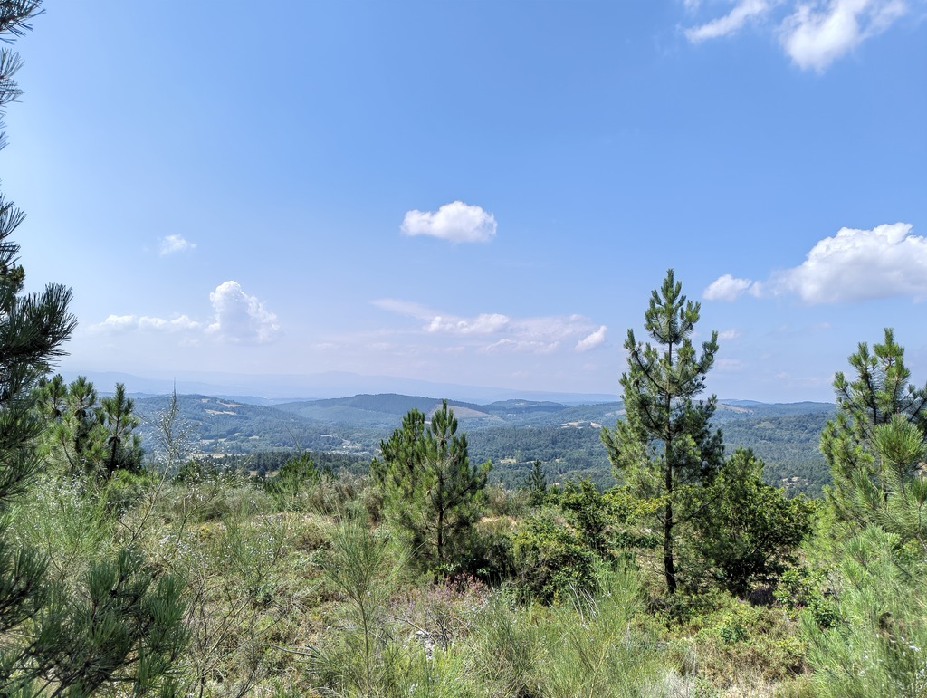
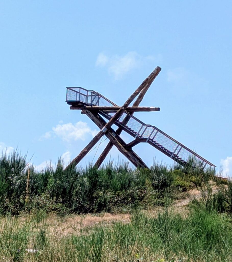
The viewpoint of Alto do Coto sits on top of the Serra das Penas, in the municipality of Bóveda, on the northern edge of the Ribeira Sacra in Lugo province. At 650 metres, it is one of the higher points in the area, and the wooden and steel platform that was built there in 2022 gives an open view over the plain of Lemos, the Montes do Iribio, O Caurel, and the Ribeira Sacra stretch of the river Sil. On a clear day the more distant ranges of Os Ancares and Pena Trevinca are visible as well.
Getting there is straightforward by car but does require the right kind of vehicle for the last stretch. From the town centre of Bóveda, we follow the LU-P-0903 in the direction of the football pitch. After passing it, the road continues for roughly 2.4 kilometres until a track branches off to the right, marked with a green sign pointing to the Serra de Penas viewpoint. From that turn, it is about 800 metres further along an unpaved forest track to reach the older Serra de Penas lookout, and a short distance beyond that, a fork splits the path in two: to the right lies the original Serra de Penas viewpoint, and to the left, Alto do Coto itself. In total the drive from the centre of Bóveda covers about 3.4 kilometres.
That final section is a dirt track, and it is better suited to four-wheel drives or vehicles with reasonable ground clearance than to low-slung cars. There is a picnic table near the fork in the path, and this last stretch is pleasant to walk as well, with space to park before continuing on foot. The Serra de Penas viewpoint next to it has, since 2024, also become a small astronomical observation point, with wooden structures for sitting and stargazing, since the area has very little light pollution.
Bóveda does not have a waymarked hiking trail that runs directly to Alto do Coto itself, so anyone wanting to combine the viewpoint with a longer walk should treat it as a separate stop reached by the access track described above, rather than as part of one of the municipality’s official routes. That said, the concello does have two homologated hiking routes that are worth knowing about if hiking is the main draw. The PR-G 269, also called the Ruta de Penacova, is a circular route of around 10 to 12 kilometres that starts at the rural accommodation of Penacova, next to an eighteenth-century ironworks that has been restored and can still be visited by appointment. The trail follows the Penacova river and its tributaries past chestnut and oak woodland, climbs to a rock formation known as Pena dos Mouros, crosses the river at a footbridge near O Pillado, passes through Fonteíña, and finishes in the village of Remesar, where traditional granaries, fountains and stone crosses mark the end of the walk. It carries the official recognition of the Galician Mountaineering Federation, which means it is properly signposted and maintained.
The second route, the Ruta de Os Trollos, is shorter and easier, at about 5.4 kilometres. It begins at the Os Trollos forest nursery, home to more than a hundred tree species, and follows a mix of road and track through the hamlet of Ribas Pequenas, past an eighteenth-century manor house and a working flour mill, before crossing the river Mao and continuing through pine, chestnut and oak forest to end near the Lugo–A Pobra do Brollón road.
Anyone planning a day around Alto do Coto could reasonably combine the drive up to the viewpoint with one of these two routes elsewhere in the municipality, along with a stop at the restored Muiño do Xil recreational area by the river Mao. None of the three is far from the others, and together they give a fuller picture of Bóveda than the viewpoint alone.